

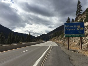
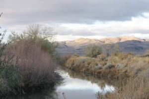
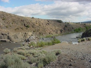
East Fork of Carson River
 |
| The headwaters of the East Fork are in the Ebbetts Pass area, and this fork flows north past Markleeville and Gardnerville to its confluence with the West Fork just a mile east of Genoa in the floor of the Carson Valley. Much of the water of the East Fork is diverted from the channel to provide irrigation for pastures and croplands in the Carson Valley. The upper reaches of the East Fork are popular hiking and fishing areas. |
| Click Here for 1991 Carson River Atlas, Department of California Water Resources |
| Click Here for Nevada USGS website |
| Click Here for Water Quality Carson River Basin USGS website |

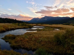
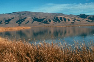
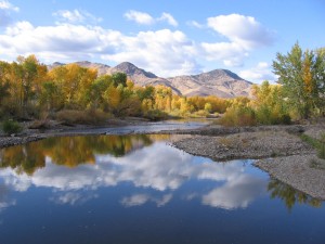
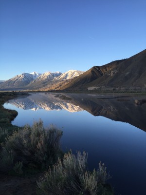
Hope Valley
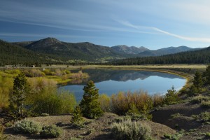 |
| Hope Valley is a broad, scenic valley in the upper reaches of the West Fork of the Carson River, extending from the top of Woodfords Canyon to the Carson Pass area. It is a popular recreation area during all four seasons. |
| Click Here for Mountain Journals website |

Virginia Range
 |
| Virginia Range is the range of dry mountains to the north of Carson City and to the east of Washoe Valley. This range was home to the wealthiest silver and gold mining boom in Nevada, the Comstock Lode. The mining settlement of Virginia City was, in the 1870s and 80s, was one of the largest and richest cities in the west. |
| Click Here for Summit Post website |
| Video Link Click Here |

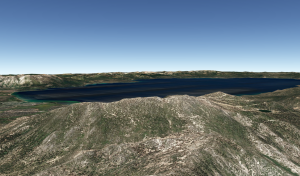
Lake Tahoe
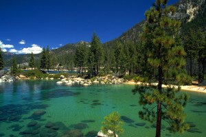 |
| This large, deep, subalpine lake is one of the clearest large lake’s in the world, and the eleventh deepest. In the 1960s, scientists measured the transparency down to an average of 105 feet into the water. By the early 2000s, we can only see an average of about 70 feet down into the water. Large scale restoration efforts are underway in hopes of halting the decline in the lake’s water quality. With more than 75% of Lake Tahoe’s watershed designated as national forest land, the area is full of recreational opportunities. Popular activities include skiing, hiking, boating, and biking. |
| Click Here for USDA The Washoe- First People of the Lake website |
| Click Here for Visiting Lake Tahoe website |
| Video Link Click Here |

Pine Nut Mountains
 |
| The Pine Nut Mountains are a large (25 by 40 mile) mountain range lying mostly in Douglas and Carson City counties, that creates the watershed divide between the Carson and Walker watersheds. The range has been home to mostly unsuccessful mining activities, and it has been mostly uninhabited except for the valleys east of Gardnerville. Most of the land is managed by the US Bureau of Land Management for public recreation, wildlife habitat, and grazing. The Washoe tribe collects, roasts, and eats the nuts of the Pinyon Pine. Historically the Washoe tribe stored these nuts as a food source during the winter months. The Pine Nut Mountains are also home to some of Nevada’s wild horse herds. |
| Click Here for Summit Post website |
| Video Link Click Here |

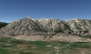
Carson Range
 |
| Carson Range is a lofty range of forested mountains which make up a portion of the Sierra Nevada range that passes to the east of Lake Tahoe. During the formation of Lake Tahoe 5 million years ago, the Carson Range and the main ridge of the Sierra Nevada west of the lake were both uplifted thousands of feet, while the crust between them sank, creating a trough that later became the floor of Lake Tahoe. |
| Click Here for Summit Post website |
| Video Link Click Here |

Hobart Reservoir
 |
| Hobart Reservoir is a small lake created in the 1800s as part of the water supply system for the booming mining center Virginia City. The reservoir is located at 7,650 feet in the Carson Range of the Toiyabe National Forest. It is stocked with rainbow trout, brook trout, cutthroat trout, bowcutt trout, and tiger trout. The reservoir is also a popular hiking and biking destination. |
| Click Here for Summit Post website |
| Click Here for Nevada Department of Wildlife website |

Marlette Lake
 |
| Marlette Lake is a high-altitude mountain lake (elev. 7823’) that can be reached by trails from Spooner Lake State Park. It is on the route of the famous “flume trail” between the lake and Incline Village. The lake is surrounded by majestic peaks, and by large aspen stands and majestic tall conifer forests. |
| Click Here for Martis Camp website |

Spooner Lake
 |
| Spooner Lake is a small lake visible from Highway 50 near its junction with State Route 28. In the late 1800s, it was the site of a major logging camp which moved logs from Tahoe down to Carson City. It is currently a Nevada State Park, famous for mountain biking and hiking in the summer, and cross-country skiing in the winter. |
| Click Here for Nevada State Parks website |
| Click Here for Nevada Department of Wildlife website |

Monument Peak
 |
| Monument Peak is a 10,067 foot peak, rising steeply above Mottsville Lane between the Carson Valley and South Lake Tahoe. Monument Peak has been developed for downhill skiing. Heavenly Valley’s highest ski lift goes to its summit. |
| Click Here for Summit Post website |
| Video Link Click Here |

Job's Peak
 |
| Job’s Peak is the spectacular triangular shaped peak rising over 5000 feet from the Carson Valley, southwest of Gardnerville. At 10,633 feet, it is one of the highest peaks near Lake Tahoe. |
| Video Link Click Here |

Mt. Siegel
 |
| Mount Siegel is the highest mountain in the Pine Nut Mountains, at 9450 feet. The prominent peak is eleven miles east of the Carson Valley golf course in Gardnerville. |
| Click Here for Summit Post website |
| Video Link Click Here |

Monitor Pass
 |
| Monitor Pass is the Highway 89 pass between the East Fork of the Carson River upstream of Markleeville and Highway 395 in the Walker Watershed near Topaz Lake. |
| Video Link Click Here |

Luther Pass
 |
| Luther Pass is the Highway 89 mountain pass between the Tahoe/Upper Truckee watershed in Meyers and the West Fork of the Carson River in Hope Valley. One of Tahoe’s largest Old Growth forests is accessible via the Tahoe Rim Trail, which has two trailheads on Highway 89. |
| Video Link Click Here |

Brockliss Slough
 |
| Brockliss Slough is a channel of the West Fork of the Carson River in the Carson Valley. The Slough carries the flow of the West Fork from a few miles north of Woodfords to its confluence with the main stem of the river east of Genoa. |
| Click Here for National Water Quality Data website |
| Video Link Click Here |

West Fork Carson River
 |
| The West Fork of the Carson River is one of two main forks draining the upper portion of the watershed from the Carson Pass area through Hope Valley and the Carson Valley to its confluence with the East Fork just east of Genoa. The upper reaches of the West Fork are popular areas for hiking and fishing in the summer, and skiing in the winter. |
| Click Here for Sierra Fish website |
| Click Here for USGS website |

Ebbett's Pass
 |
| Ebbett’s Pass is a low point in the Sierra Nevada crest where travelers pass over the watershed divide from the East Fork of the Carson on the East to the Mokelumne River on the West. In 1851, John Ebbets surveyed the pass in hopes of having found a route for the transcontinental railroad. However, he discovered that the pass was not a suitable fit for the railroad. Today the pass is a recognized as a California State Scenic Highway as well as a National Scenic Byway. |
| Click Here for Ebbett’s Pass Adventures website |
| Click Here for Calaveras History website |
| Click Here for Sierra Nevada Geotourism website |
| Video Link Click Here |

Carson Pass
 |
| Carson Pass is a low point in the Sierra Nevada crest where travelers have for 150 years crossed over the watershed divide between the West Fork of the Carson River on the East, and the Mokelumne River on the West. Named after the early frontiersman Kit Carson, the pass was a major point along the Carson Trail during the California goldrush years of 1848-1855. Today the summit of Carson Pass also houses the famous Pacific Crest Trail. At the summit, California Historical Land marker 315 identifies the area where Kit Carson left his name carved into a tree. |
| Click Here for Carson Pass website |
| Video Link Click Here |

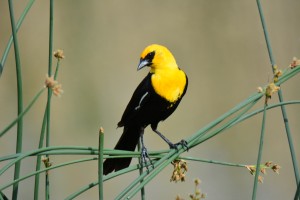
Stillwater National Wildlife Refuge
 |
| The Stillwater Marshes, along with Carson Lake, are the core of the Lahontan Valley wetlands. Located along the Pacific Flyway, the Stillwater National Wildlife Refuge (NWR) provides outstanding bird watching opportunities and is located at the foot of the Stillwater Mountains. Stillwater NWR attracts more than 250,000 swans, geese and ducks annually, including more than 10,000 Tundra Swans and large numbers of Canvasbacks. Shorebird migration is also spectacular in numbers and peaks in April and August. Stillwater NWR attracts rare birds such as the Brown Pelican, Surf and White-winged Scoter, Pomerine Jaeger and Silt Sandpiper. Stillwater Natural Wildlife Refuge is open year round. |
 |
| Video Link Click Here |
| Video Link Click Here |
| Click Here for U.S. Fish & Wildlife Service’s website |
| Click Here for Friends of Stillwater’s website |

Truckee Canal
 |
| Derby Dam, located on the lower Truckee River approximately 11 miles upstream from Wadsworth, Nevada, is the regulating structure by which Truckee River waters are diverted into the 32.5-mile long Truckee Canal. Construction on the Truckee Canal began in September of 1903, coincided with the construction of Derby Dam, and was completed in 1905. The Truckee Canal was built to carry a maximum flow of 1,500 cubic feet per second from Derby Dam to the Lahontan Reservoir through a combination of open trenches and concrete canals winding around rocky hillsides and over sandy wastes. The Truckee Canal flows past the City of Fernley supplying Truckee River water to that area. On down stream, the water from the Truckee River, by way of the Truckee Canal, combines with the water from Carson River to provide water to other Newlands Project farmers as well as to the wetlands in the Lahontan Valley. |
 |
| Click Here for the City of Fernley’s website |
| Click Here for TCID’s website |

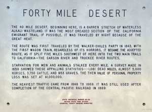
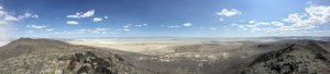
40 Mile Desert
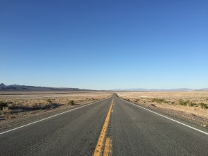 |
| The 40 Mile Desert extended from the Humboldt Sink to the Carson River, at Ragtown, located west of Fallon, Nevada. Located on the California Emigrant Trail, California bound travelers were forced to cross this desert devoid of forage and potable water in order to reach the Carson or Truckee Rivers. The loss of property, wagons, livestock, and human lives, was staggering in the early gold rush years. Sometimes called The Valley of the Shadow of Death, it was traveled by night, if possible, because of the great heat. |
 |
| Video Link Click Here |
| Click Here for Nevada Historic Marker’s website |
| Click Here for Dezert Magazine’s website |

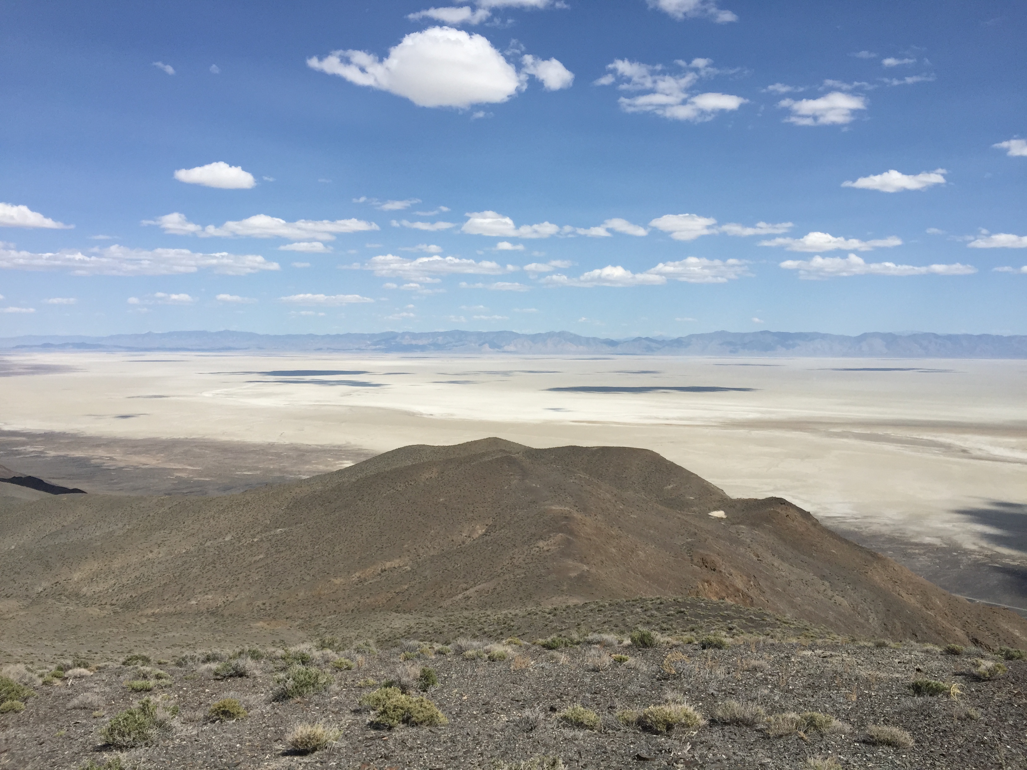
Carson Sink
 |
| The Carson River passes through the Lahontan Valley and ends at the Carson Sink and Desert. Water from the irrigation of farmlands, below Lahontan Dam, flow down stream and reach wetland areas and the sink beyond. Depending on the time of year, annual precipitation and accumulated snow pack in the upper basin, the characteristics of this area can range from an extensive labyrinth of interconnected lakes, marshes, wetlands and aquatic environments to barren, alkali desert and salt flats. The entire basin represents the largest expanse of the ancient Ice Age Lake Lahontan, which covered the Lahontan Valley and Carson Sink to a maximum depth of approximately 700 feet. |
 |
| Click Here for South West guide book’s website |
| Click Here for USGS’s website |

Lower Carson River
 |
| The lower Carson River exits Lahontan Reservoir through the spillway of Lahontan dam and flows down stream through the farmlands of Lahontan Valley. The river passes to the north of the City of Fallon, and on to the rivers end in the Carson Sink (Playa) and Desert. The lower Carson River brings water to ditches and canals that distribute irrigation water to farms in the Lahontan Valley as well as supplying water to the wetlands. |
| Video Link Click Here |
| VClick Here for NDOW’s website |
| Click Here for NDEP’s website |

Dead Camel Range
 |
| The shores of Lahontan Reservoir form the western boundary of the Dead Camel Mountains, and Churchill Valley and the Desert Mountains bound the range on the south. The lower slopes of the Dead Camel Mountains were once under pluvial Lake Lahontan and are now dominated by saltbush communities. The higher elevations of the mountain range are dominated by scrublands. The Dead Camel Range is home to cottontail, pocket gophers, long-nosed leopard lizards, and striped whip snakes as well as other desert creatures that might visit the area. Lemmon buckwheat, a sensitive plant species, can be found in the range. Some 22 species of ancient plants have been identified in the area, including evergreen live oak (canyon live oak), white fir, paper birch, European aspen and Giant Sequoia. These species contrast dramatically with the vast, arid, Great Basin Desert in which their remnants have been found. |
| VClick Here dead camel story |
| Click Here for Plant Fossil’s website |

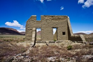
Fort Churchill Historic Park
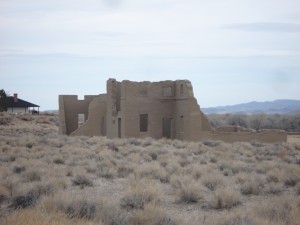 |
| Built in 1860, the U.S. Army desert outpost was established to guard early settlers. The facility also housed hundreds of soldiers between expeditions against local Indian tribes. Named after Sylvester Churchill the fort consists of adobe buildings erected on stone foundations. The fort was abandoned in 1869. The ruins are now part of the Nevada State Park system and are open to the public for exploration. |
 |
| Video Link Click Here |
| Video Link Click Here Quadcopter |
| Click Here for Nevada State Park’s website |
| Click Here for Churchill County’s website |

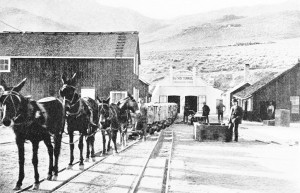
Sutro Tunnel
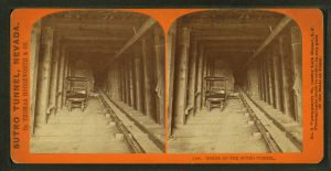 |
| Conceived by Adolph Sutro in 1860, the Sutro Tunnel was designed to drain steaming water from the Comstock mines. The tunnel begins near Dayton and extends underground for about four miles, surfacing at the base of the Virginia Range near Dayton. Over 2 billion gallons of water passed through the tunnel in 1880 alone and the tunnel continued to drain the mine shafts until 1940! A stream of water still flows from the tunnel today. |
 |
| Video Link Click Here |
| Click Here for Online Nevada Encyclopedia’s website |
| Click Here for Historical Society of Dayton Valley ’s website |
| Click Here for Lyon County’s Official website |

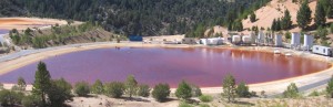
Leviathan Mine
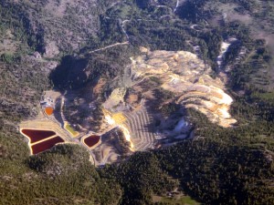 |
| Leviathan Mine is an inactive sulfur mine located in Alpine County, California on the eastern slope of the Sierra Nevada mountain range. The site covers about 250 acres and has been a source of water quality problems since the 1950’s. Operations began in 1863 for the purpose of extracting copper sulfate for processing silver ore in the Comstock mining region. Anaconda Company took over the mine in 1954 and transformed it into an open pit mine to extract sulfur ore. Over 22 million tons of overburden and waste rock were removed as a result. Anaconda sold the mine in 1962 to Alpine Mining Enterprises and the mine has been out of operation since that time. The site was formally declared a federal Superfund Site in 2000 and clean-up activities have been initiated. |
 |
| Video Link Click Here |
| Click Here for US Environmental Protection Agency’s Leviathan Mine website |
| Click Here for California Water Board#8217;s website |

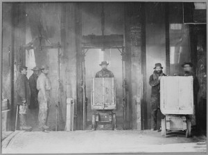
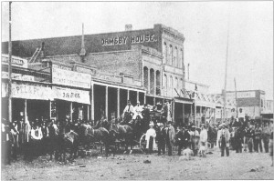
Virginia City
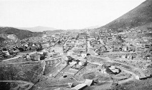 |
| Virginia City, located in Storey County, Nevada, is the largest federally designated Historical District in America. When gold was discovered in Six-Mile Canyon in 1857 Virginia City become the first industrial city in the west! The rich deposits of gold and silver ore turned the city into the most important settlement between Denver and San Francisco. Among notable residents were Mark Twain and Brete Harte. A fire in 1875 nearly destroyed the town but residents rebuilt the town in just one year! Gold and silver from the Comstock Lode yielded more than $400 million in gold and silver and remains the richest know U.S. silver deposit. Today the city retains the old west character and offers many opportunities for fun and education! |
 |
| Video Link Click Here |
| Video Link Click Here Modern Marvels |
| Click Here for Virgina City Tourism Authority’s website |
| Click Here for Storey County’s website |

Naval Air Station
 |
| When the Civil Aviation Administration and the Army Air Corps began construction of four airfields in the Nevada desert in 1942 the Naval Air Station Fallon was born. It was built as part of the Western Defense Program intended to repel an expected Japanese attack on the west coast. Over the years the station has grown to become one of the premier training sites for Navy and Marine Corps pilots and ground crews. |
| Video Link Click Here |
| Click Here for Naval Air Station Fallon’s website |
| Click Here for Churchill County’s website |

Fallon
 |
| Fallon traces its origins to 1896 when Mike Fallon built a crossroads store on his ranch property to serve the wagon trains. Near the same time the Virginia City to Fairview telegraph line was renovated linking the farms and ranches in the area. In 1902 the creation of the Truckee-Carson Irrigation District by the U.S. Reclamation Service and the construction of Newlands Irrigation Project prompted tremendous growth in the area and Fallon became the county seat for Churchill County. Fallon was incorporated in 1908. |
 |
| Video Link Click Here |
| Video Link Click Here Discover Fallon! |
| Click Here for City of Fallon’s website |
| Click Here for Fallon Tourism Authority’s website |
| Click Here for Fallon Chamber of Commerce’s website |
| Click Here for Churchill County’s website |

Silver Springs
 |
| Silver Springs, Nevada is located in Lyon County east of Reno and between Carson City and Fallon. This high desert community is near the Carson River and Lahontan Reservoir and only eight miles from Fort Churchill State Historic Park. The Silver Springs Airport provides air transportation and hanger space for flying enthusiasts. |
| Video Link Click Here |
| Click Here for Lahontan State Recreation Area’s website |
| Click Here for Lyon County’s Official website |

Stagecoach
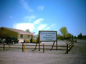 |
| Stagecoach is located on Highway 50 between Carson City and Fallon. A highway landmark for the town is the “Break-A’Heart” Saloon. Stagecoach is near Misfits Flats, named after the 1960 John Huston movie “The Misfits”. A wild horse roundup was filmed at the flats for this movie which was the last film made by Clark Gable and Marilyn Monroe. |
| Video Link Click Here |
| Click Here for Stagecoach General Improvement District’s website |
| Click Here for Lyon County’s Official website |

Dayton
 |
| Dayton is located in Lyon County, Nevada and claims to be the earliest settlement in the state. Originally called “Chinatown”, settlers were attracted to the area by the mining opportunities of the Comstock. Old Dayton is a quiet, quaint town reminiscent of a Nevada mining town. The Carson River flows through Dayton reminding residents of the importance and role that water has played in western history. |
 |
| Video Link Click Here Henry Yerington in Dayton |
| Video Link Click Here Dayton Flood |
| Click Here for Historical Society of Dayton Valley website |
| Click Here for Rriver Wranglers website |
| Click Here for Lyon County’s Official website |
| Click Here for Historical Society of Dayton Valley ’s website |

Moundhouse
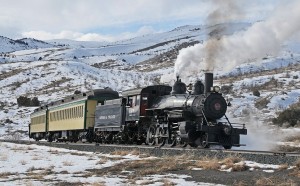 |
| Moundhouse was originally constructed in 1871 to serve as a station and siding for the Virginia and Truckee (V&T) Railroad. A post office was established in 1877 and in 1880 the V & T Railroad began construction of narrow gauge railroad from Moundhouse to mining camps in western Nevada and Owens Valley. This line was named the Carson & Colorado (C&C) and turned Moundhouse into a booming shipping point. When the C&C was abandoned in 1930’s Moundhouse all but disappeared. Today, Moundhouse offers housing options for employees of Carson City and other communities. |
| Video Link Click Here Historic V&T Railroad |
| Click Here for V & T Railroads website |
| Click Here for Lyon County’s Official website |

Ruhenstroth
 |
| The area known as Ruhenstroth is located in Douglas County, Nevada in the southwestern portion of the Pine Nut Mountains. The area contains at least 10 major paleontological zones. |
| Click Here for Carson Valley Chamber’s Tourism website |
| Click Here for Carson Valley Chamber’s website |

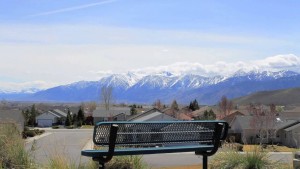
Johnson Lane
 |
| Johnson Lane is a growing community located in the heart of Carson Valley, one of the oldest and richest agricultural areas in the State of Nevada. The patchwork valley produces food supplies and supports variety of livestock. Residents of the Johnson Lane area enjoy beautiful valley vistas and views of the surrounding snow-capped Sierra Nevada Mountains. |
| Video Link Click Here Johnson Lane flooding |
| Click Here for Carson Valley Chamber’s Tourism website |
| Click Here for Carson Valley Chamber’s website |

Carson City
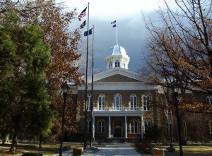 |
| Carson City was founded as a community in 1858, seven years after the first settlement of Eagle Station trading post by ranchers. The city is named after Christopher Kit Carson, the famous frontiersman and scout. Founding Fathers include well-known names such as Curry, Proctor and Musser. Carson City was selected as the state capital at the constitutional convention in 1864 and has retained that honor ever since. |
 |
| Video Link Click Here |
| Video Link Click Here Carson City Flood |
| Click Here for Carson City’s website |
| Click Here for Carson City Visitors Bureau’s website |
| Click Here for Carson City’s Chamber website |
| Click Here for Citizens for a Walkable and Bikeable Carson City website |

Indian Hills
 |
| Indian Hills is small community located approximately five miles from Carson City in Douglas County, Nevada. The community enjoys the scenic beauty of Carson Valley plus the Sierra Nevada and Carson Mountain Ranges |
| Click Here for Indian Hills General Improvement District’s website |
| Click Here for James Lee Memorial Park’s website |

Genoa
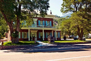 |
| Genoa was established as a trading post in 1851 to serve the wagon trains traveling between the open desert of the Great Basin and the Sierra Nevada Mountain range. The town is referred to as the oldest permanent settlement in Nevada. In 1854 the settlement was proclaimed the seat of Carson County, Utah territory, and in 1861 of Douglas County, Nevada. In 1916 the county seat was lost to Minden. In 1910 a fire devastated the community burning over half of the business district, the County Courthouse and the original Mormon Fort. Today there are about 50 original dwellings in the town including the oldest saloon in the state, the Genoa Bar. |
| Video Link Click Here |
| Click Here for Carson Valley Chamber’s Tourism website |
| Click Here for Carson Valley Chamber’s Tourism website |
| Click Here for Carson Valley ChamberRiver Fork Ranch’s website |
| Click Here for TNC River Fork Ranch’s website |

Minden
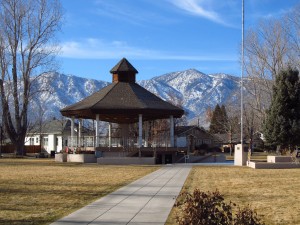 |
| Minden was established in 1905 when the V & T Railroad extended a line south from Carson City. Minden is located in Carson Valley, one of the most productive agricultural regions in Nevada and is the county seat for Douglas County. Minden began as a planned subdivision with a central park and a grid of quiet streets. Today Minden is still a picture postcard town with a turn of the century appearance. |
| Click Here for Carson Valley Chamber Tourism website |
| Click Here for Carson Valley Chamber website |

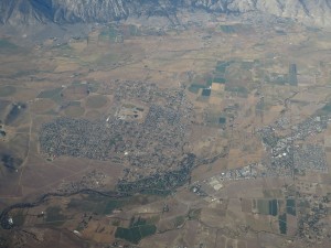
Gardnerville
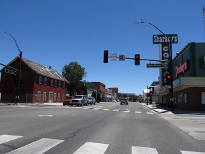 |
| Gardnerville, located in Carson Valley, Douglas County, Nevada was established in the 1860’s as a farming town. When the V&T Railroad extended its line south from Carson City in 1905 the train depot was built on the Dangberg family property located on the north side of town. Today Gardnerville is virtually fused with it neighbor Minden and provides a mixture of quaint family owned and operated shops, basque restaurants, and refurbished hotels. |
| Click Here for Gardnerville’s Official Website website |
| Click Here for Carson Valley Chamber’s Tourism website |
| Click Here for Carson Valley Chamber’s website |

Gardnerville Ranchos
 |
| The community of Gardnerville Ranchos provides housing for employees of the many casinos at South Lake Tahoe and the high-tech companies that have relocated to the Carson Valley. The surrounding mountain scenery and valley vistas provide for a quiet, comfortable community. |
| Click Here for Gardnerville’s Official Website website |
| Click Here for Gardnerville Ranchos General Improvement District’s website |
| Click Here for Carson Valley Chamber’s website |

Woodfords
 |
| Located in Alpine County, California near the Nevada border, Woodfords holds title as the oldest non-native settlement in the entire region. The area was first recorded as Brannan Springs and was considered an ideal location due to its proximity to the well-traveled California road. For a short while it was known as Carey’s Mill. In 1849, after the establishment of an official post office by Daniel Woodford, it became called Woodfords. Today the community is home to some 150 residents and serves the many travelers who pass through the area. |
| Click Here for Alpine County’s website |
| Click Here for Alpine Chamber’s website |
| Click Here for Friends of Hope Valley’s website |

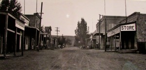
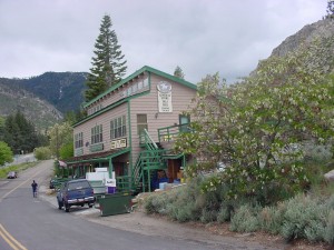
Markleeville
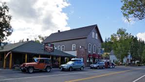 |
| Markleeville is located in Alpine County, the least populated county in the State of California. The community traces its beginnings to the land claim of Jacob Marklee in 1861. Marklee established a toll bridge across a tributary of the Carson River during the height of the silver mining boom at Silver Mountain City. When the mines closed, Markleeville assumed the county seat and to this day remains the center of government services for Alpine County. Markleeville served as a supply and shipping center for the mining, lumber and ranching industries for over one hundred years. Today, it is home to less than 200 residents and caters to numerous tourists who visit to enjoy and explore the beautiful alpine scenery and the wide variety of recreational opportunities. |
| Click Here for Alpine County’s website |
| Click Here for Alpine Chamber’s website |
| Click Here for Alpine Watershed Group’s website |

TNC - River Fork Ranch
 |
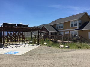
| The River Fork Ranch is an 800 acre preserve owned by The Nature Conservancy (TNC) purchased in 2000. This ranch, located where the Carson River’s East and West Forks meet, is approximately one mile east of Genoa, NV. Operating as both a nature preserve and working cattle ranch, the preserve ensures the long-term protection of key wetland, meadow and riparian habitats along a two-mile section of the Carson River. Enjoy hiking, trail running, biking, wildlife viewing, and stunning views of the Sierra Madre Nevada. The site is trails are open to the public from dawn to dusk year-round. The LEED Platinum certified Whit Hall Interpretive Center, the interpretive center, is open for scheduled events only. Click the link below to learn more about River Fork Ranch and TNC’s work protecting floodplains, restoring habitat, providing public access and implementing sustainable agricultural practices. |
 |
| Click Here for River Fork Ranch webpage |
Desert Mountains
 |
| The Desert Mountains are a mountain range located in Lyon and Churchill counties, just south of Lahontan Reservoir. The range is characterized by desert vegetation and reaches an elevation of 5,613 feet at its high point of Cleaver Peak. A second peak, Desert Peak reaches an elevation of 6,404 feet. Cleaver Peak is named after a local rancher from the 1870’s, Kirby Cleaver. |
| Click Here for Summit Post Website |
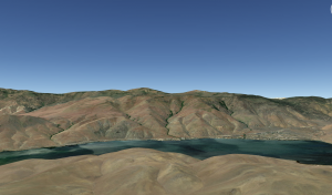
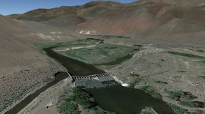
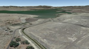
Lahontan Reservoir
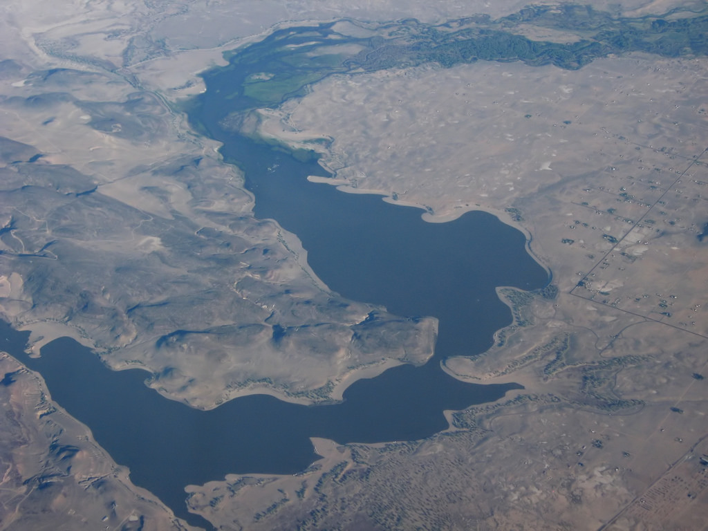 |
| Lahontan Reservoir, named after an ancient lake, was built as an irrigation project in 1905 for nearby farms. During the last ice age (25,000-11,000 years ago), ancient Lake Lahontan was as deep as 500 feet and covered 8,610 square miles. |
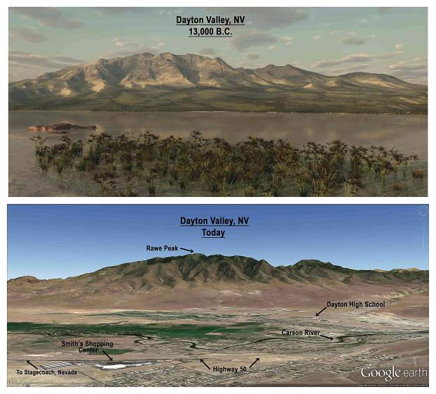 |
| The area was colder and wetter than today and contained similar vegetation. Ancient lake levels can be seen in the surrounding hills that were carved by waves to form caves and terraces. Remnants of the large lake exist today as Pyramid Lake and Walker Lake. Today, Lahontan Reservoir has a maximum depth of 85 feet and provides water for nearby communities and boasts 69 miles of shoreline with willow and cottonwood trees. The lake provides recreation for people and habitat for many animals, including Nevada’s state fish, the cutthroat trout! The prehistoric Pilot Peak strain of Lahontan cutthroat trout has been making a comeback and can reach monster sizes up to 40 pounds! |
| Video Link Click Here Lahontan Fly-over |
| Video Link Click Here Prehistoric Pilot Peak Cutthroat Trout |
| Click Here for Monster Lahontan Cutthroat Article |
| Click Here for Ice Age Nevada and Lake Lahontan Article |
| Click Here for Nevada Department of Wildlife Website |
| Click Here for Nevada State Parks Website |
Mud Lake
 |
| Also known as Mud Lake Reservoir, it is one of several lakes named Mud in Nevada. This one is in our watershed and resides in Douglas County, just 3 miles south of Gardnerville. The Dam was originally constructed in 1902 as a clay-filled dam to provide 500 acre-feet of water for irrigation. In 1909, the dam was expanded to hold 5,000 acre-feet of water. In the early 2000's, the dam was rebuilt due to earthquake concerns. |
 |
| Click Here for Mud Lake dam Article |
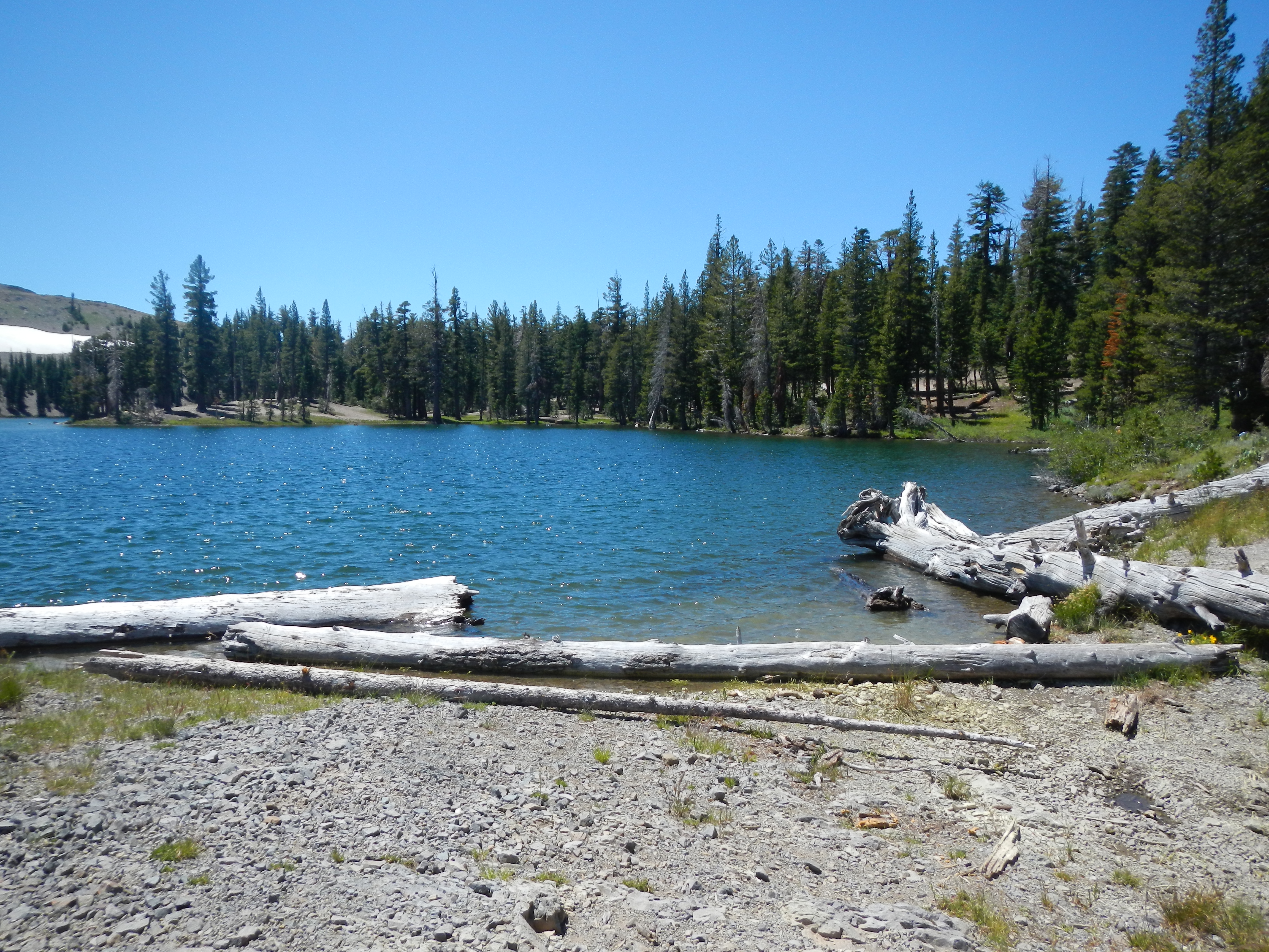
Indian Creek Reservoir
 |
| Indian Creek Reservoir is in California, just north of Markleeville. The reservoir provides a variety of outdoor recreation opportunities, including camping, fishing, hunting, hiking and boating. Two prominent fish species at the reservoir are rainbow trout and Lahontan cutthroat trout. The elevation of the area ranges from 5,600 to 6,400 feet. The landscape is dominated by pine trees and sagebrush. |
| Click Here for Recreation.gov website |
| Click Here for NorCal Fish Reports website |
Carson Sink
 |
| The Carson Sink is a playa in the northeast part of the Carson desert. The sink used to be the terminus of the Carson River, now it fed by drainage canals from the Truckee-Carson Irrigation district. |
 |
| The area was home to a UFO incident, known as the Carson Sink Case. On July 24, 1952, two air force pilots reported seeing three triangular-shaped craft flying in formation across the desert. These UFO’s were also reported by hundreds of residents. |
 |
| Click Here for Sand Dunes Video |
| Click Here for Exploring the Carson Sink Video |
| Click Here for Exploring the Carson Sink website |
| Click Here for Carson Sink UFO Case Website |
Soda Lakes
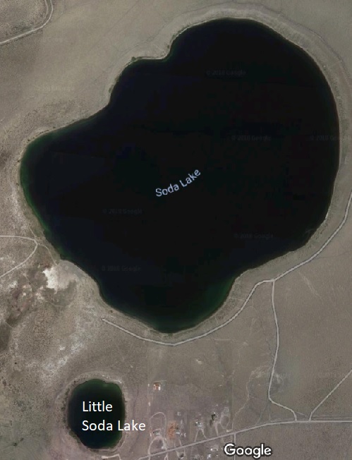 |
| Soda Lakes are two lakes northwest of Fallon, Nevada that occupy a collapsed volcanic cone. Soda lakes contain high concentrations of sodium carbonate and dissolved salts, raising the ph to alkaline levels. As such, soda lakes are extreme aquatic environments and can be inhospitable to some wildlife. The Soda Lakes near Fallon do not harbor fish or amphibians. The Soda lakes have a rich historical and cultural heritage. In 1875, commercial soda mining operations were established to mine baking soda for the lakes. The soda works were built along the edge of the lake, producing high quality, award-winning soda. The soda works became inundated by water, however, when the Truckee-Carson Irrigation project caused water levels to rise in 1903. Today, Soda Lakes offer recreation opportunities as explorers can dive to see the sunken ruins of the old soda plant 35 feet under water and a reported ghost forest of sunken cottonwood trees at the southeastern end of the lake. Visitors can also enjoy a walk around the lakes and view a wide variety of birds. |
 |
| Click Here for Story of Soda Lakes website |
Lost Lakes
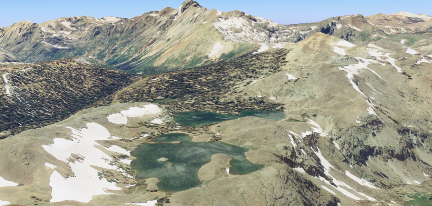 |
| Lost Lakes reside in California at an elevation of 9374 feet. This alpine region contains beautiful clear water lakes, high peaks and stunning geology. Visitors enjoy camping and hiking in the area. |
 |
| Click Here for Lost Lakes Website |
| Click Here for Lost Lakes Camper Video |