Have fun exploring your Carson River Watershed: A Lifeline Connecting Our Communities! The Carson River Watershed Map is available here to download.
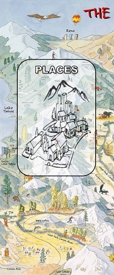
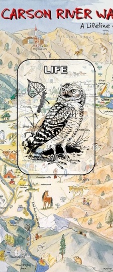
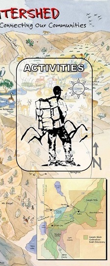
Click below to explore the places, life and activities
in the Carson River Watershed.
![]() Haz clic aquí para español
Haz clic aquí para español
Click below to explore the history
of the Carson River Watershed.
Nevada Academic Content Standards by grade level:
The Carson River Explore Your Watershed map can be incorporated into your curriculum and directly correlates to the Nevada Academic Content Standards to meet specific needs in each grade level. The Carson River Watershed Map is aligned with the Nevada Academic Content Standards (NACS) and linked to the Nevada Department of Education website for more information. If you are a teacher and would like to volunteer to help us align the map to the NACS, we welcome your involvement. Email Brenda@cwsd.org. We hope you enjoy exploring your watershed!
Kindergarten
With prompting and support, describe the relationship between illustrations and the text in which they appear (e.g., what person, place, thing, or idea in the text an illustration depicts).
Understand the relationship between numbers and quantities; connect counting to cardinality.
- Understand that the last number name said tells the number of objects counted. The number of objects is the same regardless their arrangement or the order in which they are counted.
Use a model to represent the relationship between the needs of different plants and animals (including humans) and the places they live.
Academic Standards to correlate with the online Watershed Map
Along with using the standards listed above, teachers can also use these standards when teaching using the online map.
Use observations to describe patterns of what plants and animals (including humans) need to survive.
- Lesson Ideas:
- Give students the maps; have them discuss what they see. What do the items on the map stand for (rivers, mountains, cities)? How many of each item do they see, and what do they think that means?
- Talk to students about how rivers, streams, and lakes are important for us to live. Ask them to look at the map and locate some of these bodies of water. Discuss what clues on the map told them which were water. Discuss and have them draw what would happen if the water disappeared.
Students can guess what parts of the online map are water, animals, mountains, or cities with the teacher. Discuss as a class how students know which ones are which and then the teacher can click on the green dot and read the answers on the “Towns and Places” page. Ask students what things on this map do plants and animals need to survive
First Grade
Ask and answer questions to help determine or clarify the meaning of words or phrases in a text.
Organize, represent, and interpret data with up to three categories; ask and answer questions about the total number of data points, how many in each category, and how many more or less are in one category than in another.
Identify landmarks around the world.
Ask questions, make observations, and gather information about a situation people want to change to define a simple problem that can be solved though the development of a new or improved object or tool.
Academic Standards to correlate with the online Watershed Map
Along with using the standards listed above teachers can also use these standards when teaching using the online map.
Know and use various text features (e.g., headings, tables of contents, glossaries, electronic menus, icons) to locate key facts or information in a text.
Describe the local life long ago, including jobs, schools, communication, transportation, and recreation.
- Lesson Ideas:
- Give students the maps and have them discuss what they see in the pictures. What patterns or landmarks do they seen on the map? Can they find rivers, lakes, mountains, or the city they live in? Have a discussion with students to see all the different things they found and count them up together. Create a graph to explain all the number of different landmarks, rivers, or cities they could find.
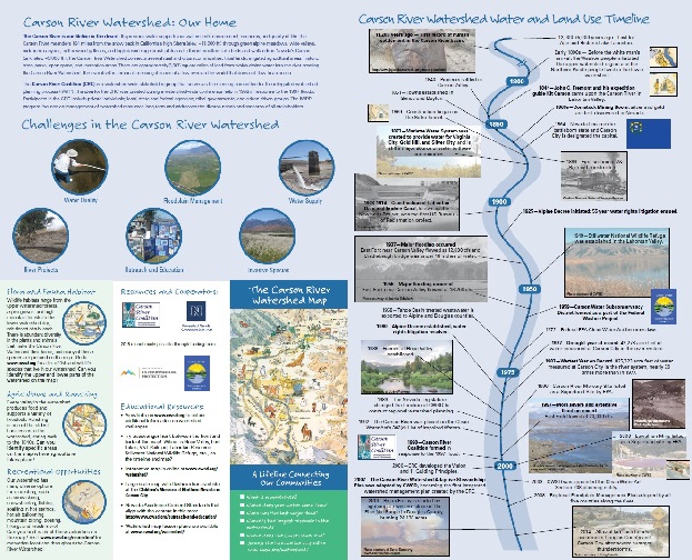
- Use the online map to have students find out more information about the locations and places around them. Have students explore the pictures and headings when they click on the green dots on the “Towns and Places” page. Discuss with students how many cities and places are around where they live, and how they all need the water from the river to live. Go through the “Carson Watershed Water and Land Use Timeline” online; discuss with students the changes that happened after reading the timeline out loud.
- Working as a class, pose a problem. “We want to start a new city. Based off the knowledge we have gained from understanding the patterns on the map, where should we build a new city? Why? Where would be place it on the map?”
Second Grade
Ask and answer such questions as who, what, where, when, why, and how to demonstrate understanding of key details in a text.
Explain how specific images (e.g., a diagram showing how a machine works) contribute to and clarify a text.
Identify titles and symbols maps.
Recognize spatial patterns, i.e., political units, physical features, on a map and globe.
Identify geographic information within media sources, i.e., maps, books, photographs.
Develop a model to represent the shapes and kinds of land and bodies of water in an area.
Obtain information to identify where water is found on Earth and that it can be solid or liquid.
Academic Standards to correlate with the online Watershed Map
Along with using the standards listed above teachers can also use these standards when teaching using the online map.
Describe the connection between a series of historical events, scientific ideas or concepts, or steps in technical procedures in a text.
- Lesson Ideas:
- Give students the maps and have them discuss what locations, places and landmarks they can identify. Discuss with students what tools they used that helped them and how the water in the Carson River affects all of these places. Where is most of the water located or come from?
- Have students draw their own version of the Carson River Watershed. Where are the mountains? Where do they live on the map? How does the water move? Where does it end up? How is there map different from the real one?
- Teacher reads though the “Carson Watershed Water and Land Use Timeline” online, and have students discuss how the river has changed. Which changes were caused by people, and how did this affect the river and others? Do they have predictions based on the patterns that they see? Discuss their findings.
Third Grade
Use information gained from illustrations (e.g., maps, photographs) and the words in a text to demonstrate understanding of the text (e.g., where, when, why, and how key events occur).
Compare uses of maps and globes
Identify and explain simple spatial patterns on a map, i.e., population centers, farmland, mountains.
Make a claim about the merit of a solution to a problem caused when the environment changes and the types of plants and animals that live there may change.
Academic Standards to correlate with the online Watershed Map
Along with using the standards listed above teachers can also use these standards when teaching using the online map.
Use key features and search tools (e.g., key words, sidebars, hyperlinks) to locate information relevant to a given topic efficiently.
Compare ways people modify the physical environment
- Lesson Ideas:
- Have students discuss in groups what they notice about the map, and what details they see. Discuss what patterns or symbols they noticed that help them read the map. Talk about how maps have features that help them give information. Have them find what information they can gather from the map about the Carson River. How could the river affect the animals and people around it?
- Give students a problem. “Every year in spring the Carson River Floods and animal habitats are destroyed.” Discuss as class possible solutions to the problem. Have students pick one of the solutions and explain why they think it is the best solution for the problem. Locate the areas on the watershed map that are likely to flood or where they would place their solution.
- Have students work in groups to discover more about the locations and places in Northern Nevada by reading about a few towns on the map by clicking on the green hyperlink dots on the online map for “Towns and Places.” Have them share their findings with the class and discuss how the places around the Carson River may need the river to survive and grow.
Fourth Grade
Analyze and interpret data from maps to describe patterns of Earth’s features.
Refer to details and examples in a text when explaining what the text says explicitly and when drawing inferences from the text.
Conduct short research projects that build knowledge though investigation of different aspects of a topic.
Identify spatial patterns on a map of Nevada, i.e., deserts, mountains, population.
Academic Standards to correlate with the online Watershed Map
Along with using the standards listed above, teachers can also use these standards when teaching using the online map.
Explain events, procedures, ideas, or concepts in a historical, scientific, or technical text, including what happened and why, based on specific information in the text.
Interpret information presented visually, orally, or quantitatively (e.g., in charts, graphs, diagrams, timelines, animations, or interactive elements on Web pages) and explain how the information contributes to an understanding of the text in which it appears.
Identify regional changes in Nevada over time.
- Lesson Ideas:
- Have students read “Carson River Watershed: Our Home” on the online map and find the Sierra Nevada Mountains, rivers, cities, and Carson Sink on the map shown above. Discuss with students what patterns on the map helped them find these landmarks. Students can also locate the different types of animals on the map, and discuss how they use the land, especially the Carson River, to help them survive.
Students click on the green hyperlink dots on the online map for “Towns and Places” to discover more about places around Nevada. Students will work in groups to research their place and discuss and write about how their place might have changed over the course of time.
Fifth Grade
Develop a model using an example to describe ways the geosphere, biosphere, hydrosphere, and/or atmosphere interact.
Obtain and combine information about ways individual communities use science ideas to protect the Earth’s resources and environment.
Explain the relationships or interactions between two or more individuals, events, ideas, or concepts in a historical, scientific, or technical text based on specific information in the text.
Identify and locate major geographic features in Nevada and the United States using map elements.
Describe ways physical environments affect human activity in the United States using historical and contemporary examples.
Academic Standards to correlate with the online Watershed Map
Along with using the standards listed above teachers can also use these standards when teaching using the online map.
Derive geographic information from photographs, maps, graphs, books, and technological resources.
Draw on information from multiple print or digital sources, demonstrating the ability to locate an answer to question quickly or to solve a problem efficiently.
- Lesson Ideas:
- Using the flip side of the map, have students read, “What is the Carson River Watershed?” and “Carson River Restoration History.” Discuss with students the parts of the Carson River Watershed. Then, find them on the other side of the map. Ask students why the Carson River would need restoration, and what kinds of human activities cause damage to the river.
- Students should read, “Habitats and Vegetation” and “Fish and Wildlife” on the back of the watershed map. Have them pick an animal from the front of the map to learn more about their lifestyle in their habitat. Students should use other types of media and sources, along with the map, to discover how their animal’s habitat may change with the pollution of the river.
- Have students draw a picture of their animal existing in their habitat. Have them label the four spheres in their drawing, and write a sentence explaining how two of the spheres are interacting in their drawing. Also have them explain where their animal might live on the map so that it has all the requirements it needs to live.
6th - 8th
Nevada State Standards
Students will evaluate how changes in environments can be beneficial or harmful.
Students know scientific knowledge is revised though a process of incorporation of evidence gained though on-going investigation and collaboration discussion.
Students know the characteristics, abundances, and locations of renewable resources found in Nevada.
NGSS Standards
Develop a model to describe the cycling of water through Earth’s systems driven by energy from the sun and the force of gravity.
Construct an argument supported by evidence for how increases in human population and per-capita consumption of natural resources impact Earth’s systems.
Academic Standards to correlate with the online Watershed Map
Along with using the standards listed above teachers can also use these standards when teaching using the online map.
Nevada State Standards
Compare Earth’s physical and human features using maps, fieldwork, graphic representations, aerial photographs, satellite images, and technological resources.
Locate major civilizations, ancient though current, and describe how and why these regions changed over time.
- Lesson Ideas:
- Give students the maps and have them discuss the resources that benefit the community living in the Carson Watershed. Students should read the section on the back of the map titled, “Agriculture and Ranching.” Using the map and online resources, students should research and discuss how agriculture and ranching affect the watershed in the community.
- After reading the “Carson Watershed Water and Land Use Timeline” online, students should discuss how the watershed has changed over time. Students should discuss and explain how multiple cultures have used the river and surrounding area for their livelihood and how this has affected the watershed over time.